Première Partie de la Carte de l'Intérieue de la Louisiane, par Z. M. Pike
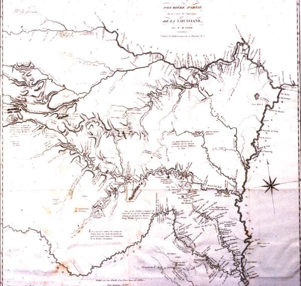
Delineates western explorations of Zebulon Pike, 1805-1807, from just south of Natchez, up the Mississippi River to the mouth of the Ohio, up the Missouri River to the mouth of the Platte River. Shows Arkansas River from its mouth on the Mississippi River . Red River from the Mississippi River to Red River Raft.
d'Hautel
[Paris]
English edition of this map, not original, located 1971.051.003. Plate II from this source, a French original and English non original edition located 1981.065.032 and 1971.051.001, respectively.
Plate I from d'Hautel's "Voyage au Noveau Mexique" translated by M. Breton from Pike's 1810 " An Account of Expeditions to the Sources of the Mississippi, and through the Expeditions to the Sources of the Mississippi, and through the Western Parts of Louisiana During the Years 1805, 1806, and 1807, Etc."