Topographical and Drainage map of New Orleans and Surroundings
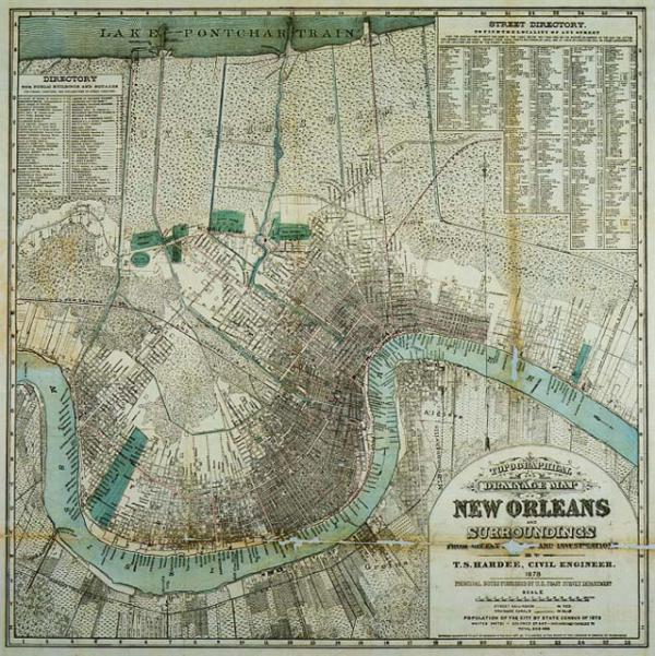
New Orleans, topography, drainage. 1875 census. Booklet includes map of Mississippi River delta: "Eads Jetties at South Pass of the Mississippi, " and "Bird's Eye View: View of the Jetties from Light House looking Seaward." Booklet lists names of city officials, district and ward description, location of fire department signal boxes, street railroads, cotton presses, freight and passenger rail roads, banks, s insurance companies, retail establishments, clothing stores, grocers, short history of 1874 Battle for Liberty Place, reconstruction.
Hardee,T[homas] S., civil engineer
[New Orleans, La.]
Second copy, not conserved, located 9762.002.
Denotes New Orleans' population numbers by race, including "Indians and Chinese," and notes that "principal notes furnished by U. S. Coast Survey Department." Includes directory for public buildings and squares. From pocket map titled, "Hardee's New Map of New Orleans, Including Street Guide, 1878." Booklet lists names of city officials, district and ward description, location of fire department signal boxes, identifies street railroads, business directory location of cotton presses, freight and passenger rail roads, banks, several advertisements for insurance companies, retail establishments, clothing stores, grocers, short history of 1874 Battle for Liberty Place, Reconstruction.