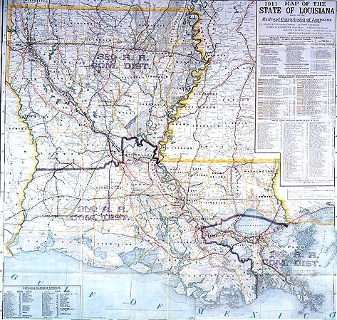
1911 Map of the State of Louisiana issued for the Railroad Commission of Louisiana as a Supplement to its Twelfth Annual Report
Sub-Title
Showing the Railroad Systems of the State, the Distances between Stations, the Post offices, the Waterways, and containing a detail of information of use to Shippers and Travelers
Subject
Louisiana; railroads; parishes; communication systems; members of the railroad commission (names thereof), transportation
Date
1911
Mapmaker
Cram, George F.
Publisher
Cram, George F.
Place of Publication
Chicago
Accession Number
1994.003.017
Notes
Notes location of Prepaid Express and Freight Stations (American Express, Pacific Express, etc;); names of telegraph and telephone companies in operation; indicates total mileage operated by railroads and the express company operating on each; all railroad stops
Size
37 1/2 x 39 1/4