America Settentrionale Colle Nuoue Scoperte sin all' Anno 1688 [North America in the Year 1688)
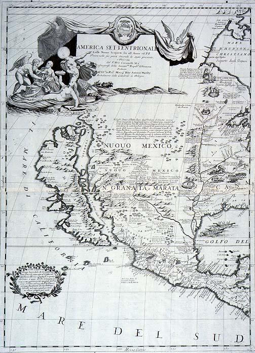
North American continent, exploration, Marquette, La Salle, Great Lakes Region, California as an island, location of Indian tribes, depiction of daily Indian activities: harvesting, fishing, food prepartaion.
[Coronelli, [Vincenzo Maria]
Venice
Includes great cartouches. See Phillips, Vol. 1, p. 258-59, #521.
Plates 9a-b from Coronelli's 1696 "Atlante Veneto." One of the most important and influential late 17c commercial printed maps of North America. When published it presented an accurate portrait of the interior of the North American continent because Coronelli used information supplied by official reports of French explorers and Jesuit missionaries. The map notes the voyages of Marquette in 1673 and La Salle in 1682. Because of La Salle's located the Mississippi River near the Rio Grande River, about 600 miles west of its actual location, the Mississippi River is not accurately depicted on this map. The error was corrected after Pierre Le Moyne, Sieur d' Iberville, reached the mouth of the river in 1699 and subsequently reported its true location. One of the most accurate 17c maps depicting the Great Lakes region. Includes notation that it was recently believed that California was a peninsula, but that three expeditions (1634, 1639, 1642) determined that California was an island.