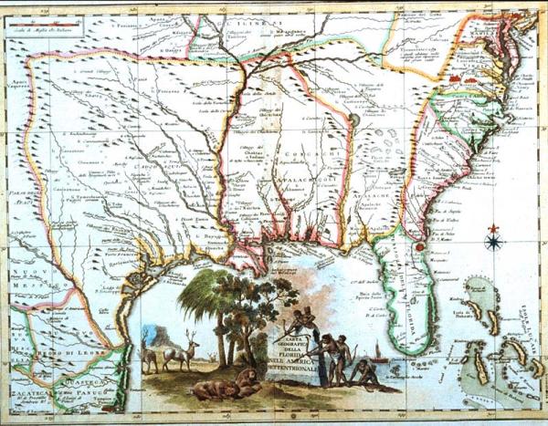
Carta Geografica Della Florida Nell'America Settentrionale [Geographical Map of Florida in North America]
North America
unidentified
unidentified
Earlier curators attributed this map to Isaak Tirion, a Dutch cartographer. There is no evidence to support this attribution, esp. since it is an Italian map, not Dutch. See Phillips for Tirion's work. Others have attributed it to Zatta, and dated it 1778, from Raynal's "Amerique Septentrionale." There is no evidence in Phillips (see Vol I-II, p. 379-385, #650-52) to suppurt this attribution, either. 1/23/01 + 4/1/99, KP.
While partly relying on Deslisle's 1718 "Carte de La Louisiane," this unidentified Italian mapmaker omitted much detail, including the founding of New Orleans in 1718. One of the remarkable features of this map is the title cartouche depicting sleeping lions. European engravers and map makers commonly confused attributes of the Americas with those of Africa, and often interchanged flora and fauna of these continents. It is also possible that the engraver was attempting to illustrate the American cougar, described by early explorers as a lion.