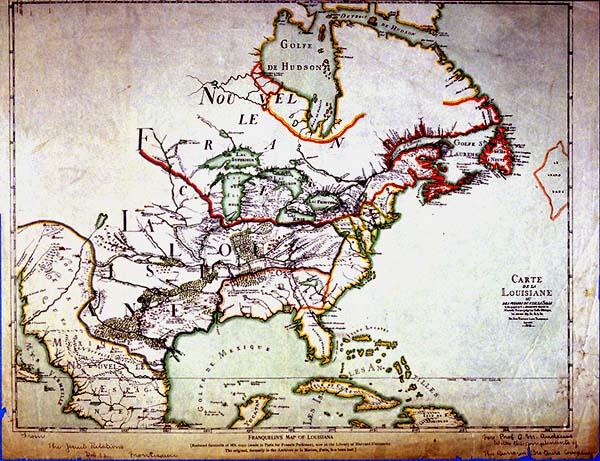
Carte de la Louisiane
Colonial Louisiana from Canada to the Gulf of Mexico
See 1955.002.031.002 for b + w photograph of original ms. Copy in Archives national.
The original manuscript of this map, a foundation map of colonial Louisiana, has never been found. This is labeled an "enhanced reproduction with added material." This reduced facsimile of a manuscript copy made in Paris from the original located in the Archives Nationales bears the notation, "For Prof.[A.?] M. Andrews with the compliments of The Burrows Brothers Company" in the lower right margin and a second notation, "From The Jesuit Relations Frontispiece Vol. 63" located in the bottom left margin.
This is a foundation or "mother" map of colonial Louisiana. Throughout history, certain maps which, because of accurate details and incorporation of the results of recent explorations, cartographers call "foundation" or "mother" maps. The influence of foundation maps persisted long after later discoveries and settlements because until the nineteenth century, most mapmakers reproduced their predecessors work.