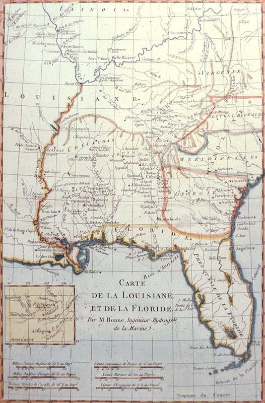
Carte de la Louisiane, et de la Floride
Subject
Colonial Louisiana, from the Mississippi River in the west, to Charleston in the east; and from the Gulf of Mexico to the Illinois River. Many Indian tribes and early European settlements located. Several eighteenth-century Indian tribes living in the present-day areas of Mississippi, Alabama, Missouri, Illinois,Tennessee, and Kentucky are located on this map.
Date
1780
Mapmaker
Bonne, [Charles Marie Rigobert]; André, engraver
Publisher
[Pellet, J. L.]
Place of Publication
[Paris]
Accession Number
1980.014.005
Curatorial Notes
Other copies/editions located T0019.1976; 00885, 1997.078.072. Although a previous cataloger identified this as coming from Bonne's "Atlas de Toutes les Parties", the title does not match that in Phillips, Vol. 1, p. 385, #652.
Insets
[Area surrounding Missouri River, showing location of Fort d'Orleans (abandoned), and land of the Osage Indians]
Notes
Plate 46, Vol. 16 from Guillaume Thomas François Raynal's "Atlas de toutes les Parties Connues du Globe Terrestre."
Size
12 3/8 x 8 1/4