Carte de La Louisiane et des Pays Voisins
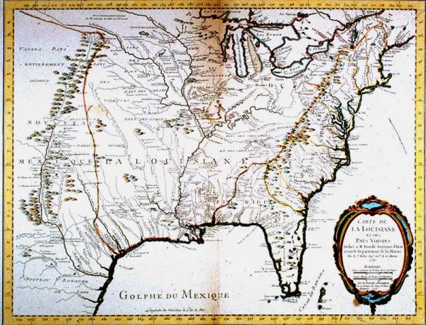
Colonial Louisiana from New Mexico to the Atlantic seaboard, Gulf of Mexico to Canada; location of Indian tribes
Paris
Second copy located 1997.078.072. Label from exhibition: the next entry in the "war of the maps" came from Jacques Bellin. In this work, Bellin atempted to locate the Spanish, French, and British settlements along the eastern seaboard. All of the English colonies are closely contained east of the Appalachian mountains. This map is one of the better imitations of Deslisle's 1718 map of Louisiana. However, Belin did not include De Soto's route to the west, eliminated several outdated references, and added information derived from recent explorations.
In this work, Bellin located Spanish, French, and British settlements along the eastern seaboard. This map is one of the better imitations of Deslisle's 1718 map of Louisiana. Unlike Deslisle, Bellin did not include De Soto's western routet, eliminated several outdated references, and added information derived from recent explorations.