Carte de la Louisiane et Pays Voisins
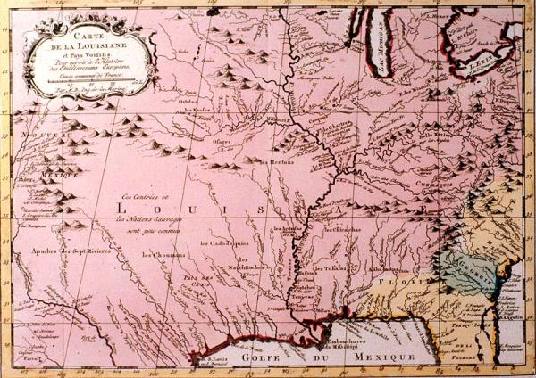
Colonial Louisiana from Canada to the Gulf of Mexico; New Mexico to St. Augustine, Florida; location of Indian tribes
[Paris ?]
Nicely colored. Other editions located 1980.014.001, 00595, 01245. Although earlier curators attributed this to Bellin's "Petit Atlas Maritime," there is no evidence in Phillips (see Vol 2, p. 349, #3508, plate 40) to support this attribution. This appears to be an adaptation of the original plate printed in Bellin's "Petit Atlas." "National boundary claims---French, Spanish, English---not engraved into the map but are roughly indicated by color, indicating the vagueness of boundary lines in the 1760's-1770's. Area mapped extends from Santa Fe in the West to just past Williamsburg in the east. Lower half of Florida not shown. French Louisiana extends from the Appalachians west and north to the limits of the map.