Carte de la Louisiane [Map of Louisiana]
Subject
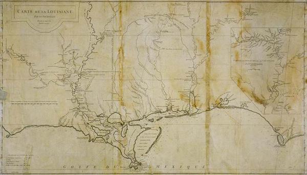
Detailed map of French settlement of the Louisiana Gulf Coast east to Apalachicola River in Florida, west to Cabo del Norte; Louisiana waterways, location of Indian tribes; Red River; Mississippi River, abandoned colonial French settlements at Biloxi and below New Orleans, Fort Prudhomme, Fort Margot [Memphis].
Date
1732 May (historical)
Mapmaker
Anville, Jean Baptiste Bourguignon d'
Publisher
De la Haye, Guillaume
Place of Publication
[Paris]
Accession Number
T0101.1996.0011
Alternate number
00361 (wrong #)
Curatorial Notes
Printed on three sheets, joined. Was assigned the following incorrect accession #: 00361
Insets
Partie Supérieure de la Louisiane Pour s'étendré d avantage, on consultera la Carte de l'Amerique Septentrionale du méme Auteur [Fort Prudhomme]
Notes
This is a 1752 edition of a 1732 map. Fort Prudhomme was located in what is now Lauderdale County, Tennessee.
Media Type
mounted on cloth
Size
20 3/8 x 36