Carte de l'Intérieur de la Louisiane [Map of the Interior of Louisiana]
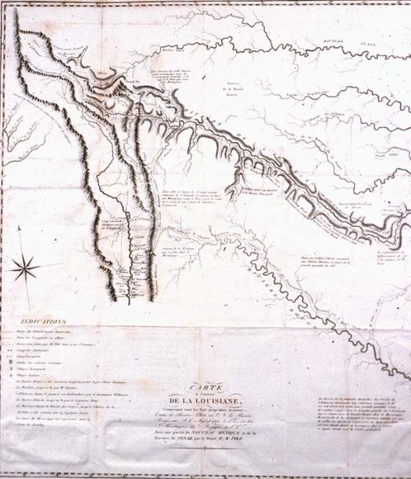
[Including all the hitherto countries lying between the Platte River and the Missouri River on the North and the Red River on the South, the Mississippi to the East and the mountains of Mexico to the West, with a part of New Mexico and the province of Texas.]
Platte River, Red River, Arkansas River, Rio Grande River
d'Hautel
Paris
This was formerly stored c5d10. English edition of this map, not an original, located 1971.051.001. Plate I from this source, a French original and English non original edition located 1981.016 and 1971.051.003, respectively.
Plate II from d'Hautel's "Voyage au Noveau Mexique," translated by M. Brenton from Pike's 1810 "An Account of Expeditions to the Sources of the Mississippi, and through the Western Parts of Louisaina...during the years 1805, 1806 and 1807, etc." Map delineates Pike's exploration along the upper Arkansas and Rio Grande Rivers. The Spanish cavalry sent in search of Pike preceded him up the Arkansas and Pike followed them marking their campsites on his maps. The upper waters of the Red and other rivers are poorly delineated.