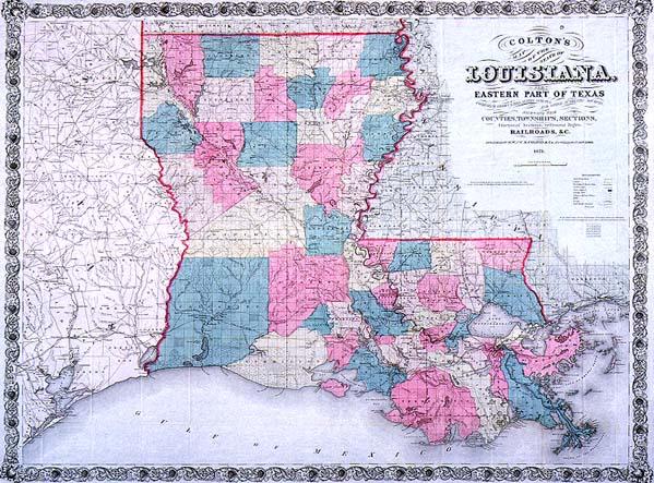
Colton's Map of the State of Louisiana and Eastern Part of Texas
Sub-Title
Compiled from United States Surveys, and other authentic sources, shewing [sic] the Counties, Townships, Sections, Fractional Sections, Settlement Rights, Railroad, &c.
Subject
Louisiana township and range map
Date
1871
Publisher
Colton, G[eorge] W[oolworth] and C[Charles] B.
Place of Publication
New York
Accession Number
1993.001.007
Curatorial Notes
Nicely colored, great border. We also have 1864 edition, located 1963.021.
Notes
This is an 1871 edition of J. H. Colton's map first published 1863.
Size
29 x 38