Dalcour [subdivision] Plaquemines Parish, La.
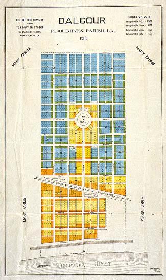
Dalcour [subdivision] Plaquemines Parish, La. Dalcour Plantation, Mary Farms, land subdivision.
Fidelity Land Company
New Orleans, La.
After the subdivision developers sold the lots, they did not develop a supporting infrastructure for the subdivision, and failed to install electricity, sewerage, build streets, running water. The land remains undeveloped to this day (1998), and heirs of the original buyers cannot sell the land because of the lack of infrastructure.
This map delineates Dalcour subdivision, carved from the Dalcour Plantation. It was located c. 5 miles South of Braithewaite, La., near present-day English Turn. The subdivision fronted on the Mississippi River; the back lots were located along present-day Highway 39; Mary Farms subdivision was located on either side.