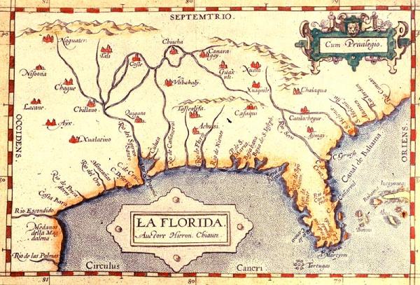
Florida, La
Subject
Colonial Louisiana, Florida, Gulf Coast
Date
1584
Mapmaker
[Chavez, Geronimo]
Publisher
[Ortelius, Abraham]
Place of Publication
Antwerp
Accession Number
1956.517a
Exhibition History
1996 Sep - Mar 30, 1999, So Much More than Just A Map Dec 1982-1984: map exhibition in Presbytere.
Notes
From Ortelius's "Theatrum Orbis Terrarum." One of the few sixteenth maps of the area based on Spanish sources, information was supplied by the Spanish royal cartographer Geronimo Chiaves, from data compiled derived from DeSoto's 1539-1543 exploration. This map includes territory south of present-day Virginia west to New Mexico. It is the first separate PRINTED map of Florida and the Southeast and is a foundation" map of the area. Until the late eighteenth century it was used as the basis for maps and charts drawn by subsequent mapmakers, who for forty years after its publication widely imitated or copied it outright.
Size
6 x 8 7/8