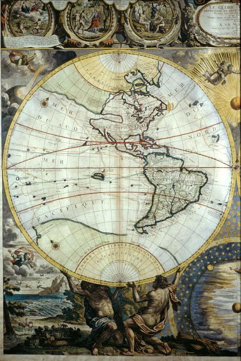
Globe Terrestre Representé En Deux Plans-Hemispheres, Le
Subject
World, hemispheres, zodiac, Genesis, exploration, Northwest Passage, trade routes.
Date
1700
Mapmaker
Nolin, J[ean] B[aptiste]
Publisher
Nolin, Jean Baptiste
Place of Publication
Paris
Accession Number
1982.077.114
Alternate number
Seiferth Collection
Curatorial Notes
Map is framed. Map originally printed in seven sheets but joined together before Bocquet's coloring in 1700.
Exhibition History
1992 treasures exhibit, Presbytere, 1992-1999. Dec 1982-1984: map exhibition in Presbytere.
Notes
Delineates discoveries of early explorers (Pointy, Tasman, Magellan, Mendana, Chaumont, Le Maire, Olivier) and some claims to territory. Includes circle of the zodiac, compass roses. Surrounded by biblical images from Genesis. Delineates trading routes from Brest to the Dutch East Indies. New Guinea and Australia are depicted as a vast island. Hope for the discovery of a northwest passage in North America is delineated by the connection of a "Baye du Nord" in northern Canada with the Pacific Ocean by means of a long river.
Size
37 x 49