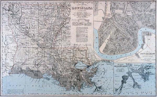
Gray's New Map of Louisiana
Subject
Louisiana parishes, New Orleans, Mississippi River delta, railroads, canals, light houses, light ships. New Orleans ward boundaries.
Date
1878
Mapmaker
Gray, Frank A.
Publisher
Gray, O. W. & Son
Place of Publication
Philadelphia
Accession Number
1997.001.006.01
Alternate number
Seiferth Collection
Curatorial Notes
This was purchased to replace 1982.077.008, destroyed in 1988 Cabildo fire.
Insets
1. City of New Orleans 2. The Passes of the Mississippi River
Notes
Plate 90-91 from "The National Atlas, Containing Elaborate Topographical Maps of the United States." Various editions 1875-1882.
Size
16 1/4 x 26 1/16