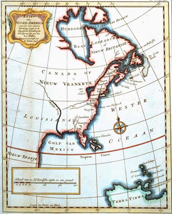
Kaart van Noord America voor zoo verre dezelve betrekking heeft tot de Engelsche Bezittingen [Map of Norh America Insofar as It Pertains to the English Possessions]
Subject
North America, east of Texas to the Atlanatic ocean, Gulf of Mexico, Central America.
Date
1746
Mapmaker
[Tirion, Isaak?] after Jaques N. Bellin's original
Publisher
Boitet, R[einer]
Place of Publication
Delft
Accession Number
1997.078.031
Alternate number
Lupin Collection
Curatorial Notes
Outline color. Label from 1996 exhibit: this Dutch map is a fine example of the Europeans penchant for cartographically claiming huge swaths of land on the North American continent. Territoru east and south of Hudson bay is claimed in the name of France and Britain. Central America is labelled New Spain. Although manu Western place-names along the eastern seaboard are identified, no Indian tribes are located, thereby discounting the exitence of America's indigenous populations and their claims to the land.
Exhibition History
1996 Sep - Mar 1998, So Much More than Just a Map
Size
10 3/4 x 8 5/8