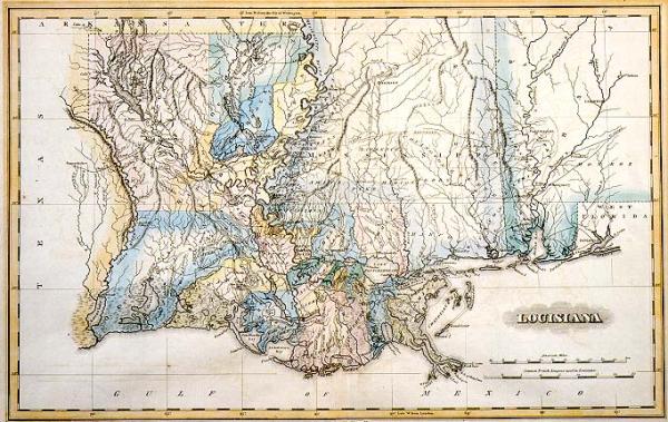
Louisiana
Subject
Louisiana
Date
1824
Mapmaker
Lucas, Fielding, Jr.
Publisher
Lucas, Fielding, Jr.
Place of Publication
Baltimore
Accession Number
1997.001.010.05
Notes
Notes the area covered by the Attakapas District, before the creation of Lafayette Parish on Jan 17, 1823. From Lucas' "General Atlas Containing District Maps of All the Known Countries in the World." Only 25 parishes located, shows New Orleans as the capitol, and Monroe (with Fort Miro nearby).
Size
10 3/16 x 17 1/4