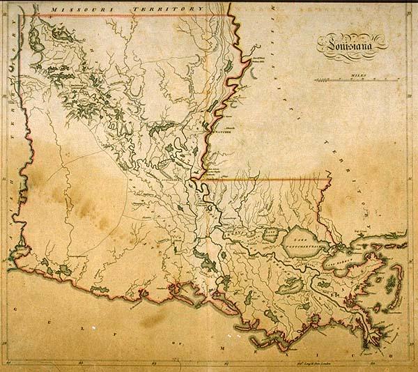
Louisiana
Subject
Louisiana, parishes; Attakapas; Cote Allemande, German Coast, Indian tribes, the Opelousa (Oppaloussas) (Appaloosas)
Date
[1814]
Publisher
Carey, Mathew
Place of Publication
Philadelphia
Accession Number
1993.058.001
Curatorial Notes
Second copy located 1997.078.047. To replace T0031.1982, burned in 1988 fire
Notes
From Mathew Carey's "General Atlas;" one of the first maps of Louisiana after statehood in 1812. It shows little detail of the prairies of southwestern Louisiana since they were sparsely populated. Two Indian tribes, the Opelousa (Oppaloussas) and the Attakapa Indians inhabited this area during the eighteenth and early nineteenth centuries.
Size
15 1/2 x 17