Louisiana
Subject
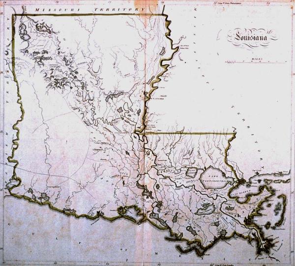
Louisiana, parishes; Attakapas ; Cote Allemande, German Coast, Indian tribes, the Opelousa (Oppaloussas)
Date
[1814]
Publisher
[Carey, Mathew]
Place of Publication
[Philadelphia]
Accession Number
1997.078.047
Alternate number
Lupin Collection
Curatorial Notes
Second copy located 1993.058.001.
Exhibition History
1996 Sep - Mar 30, 1999, So Much More than Just A Map
Notes
From Mathew Carey's "General Atlas;" one of the first maps of Louisiana after statehood in 1812. It shows little detail of the prairies of southwestern Louisiana since they were sparsely populated. Two Indian tribes, the Opelousa (Oppaloussas) and the Attakapa Indians inhabited this area during the eighteenth and early nineteenth centuries.
Size
15 1/2 x 17