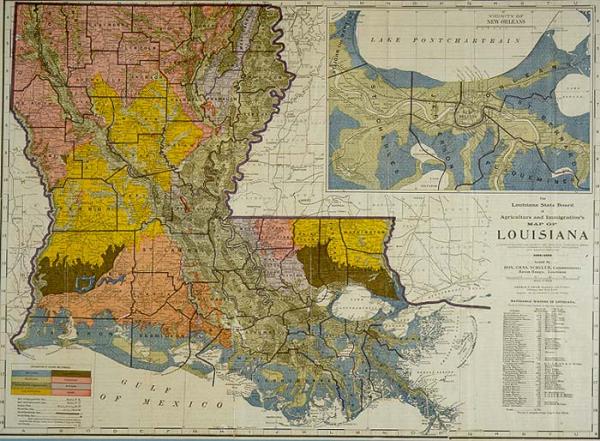
Louisiana State Board of Agriculture and Immigration's Map of Louisiana, The.
Sub-Title
A Phytogeographic Map Showing the Principal Vegetation Areas, All Principal Commercial Points, Town Populations and Railway Distances.
Subject
Louisiana; includes agricultural and geographical description of each parish (area, population, elevation, etc); natural resources, parish seats, light houses
Date
1907
Mapmaker
Cram, George F., engraver
Publisher
Cram, George F.
Place of Publication
Chicago
Accession Number
T0101.1996.0013
Curatorial Notes
Includes "names of navigable waters, miles of operation, head of navigation."Denotes alluvial, marsh, prairie, bluff lands; wooded alluvial or cypress lands; long-leaf pine flats and hills; uplands; location of salt, sulphur,oil, gas
Insets
Vicinity of New Orleans. Includes St. John the Baptist, St. Charles, Jefferson, Orleans, St. Bernard, Plaquemines Parishes.
Notes
Issued by Louisiana Board of Agriculture and Immigration, Chas. Schuler, commissioner. Includes image of Schuler.
Size
17 1/2 x 24