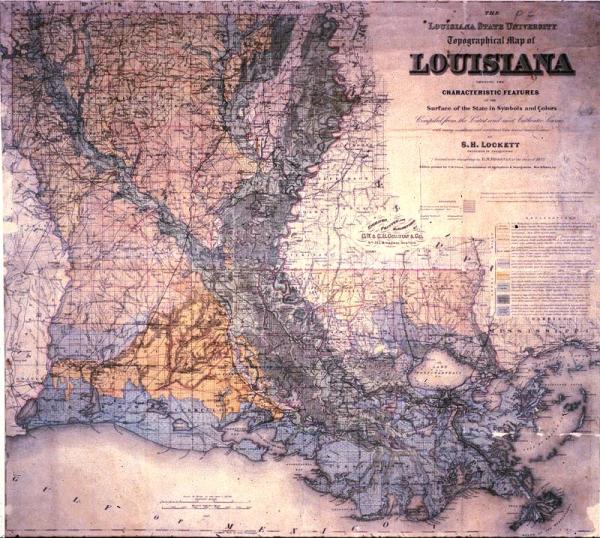
Louisiana State University Topographical Map of Louisiana Showing the Characteristic Features of the Surface of the State in Symbols and Colors
Sub-Title
Compiled from the Latest and most Authentic Sources with many additions and corrections from the actual reconnaissance by S. H. Lockett
Subject
Louisiana; township and range map; railroads
Date
1891
Mapmaker
Lockett, S.H., assisted in the draughting by D. M. Brosnan of the class of 1872
Publisher
Colton, G[eorge] W[oolworth] and C[Charles] B.
Place of Publication
Washington, D. C.
Accession Number
8173.015
Curatorial Notes
Second copy, poor condition, located T0055.1997.0040
Exhibition History
1982: Lafayette Natural History Museum
Notes
Color coded to delineate "good uplands," "pine hills," "bluff lands," "pine flats," "prairies," "alluvial lands," "coast marsh," "wooded swamps."
Media Type
mounted on cloth
Size
30 x 33 1/2