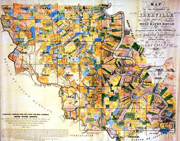
Map of the Parishes of Iberville most of West Baton Rouge and Including Parts of the Parishes of St. Martins (sic), Ascension, and Pointe Coupee Louisiana
Sub-Title
Accurately Compiled from the Latest and Most Authentic United States Surveys [and] The Records of the Federal and State Land Offices, the Files of the Several Recorders' Offices, the Titles of the Various Proprietors Whose Lands are Represented and all Other Accessible and Reliable Sources of Information
Subject
Iberville, West Baton Rouge, St. Martin, Ascension, Pointe Coupee parishes; township and range map; plantations, Mississippi River, Lower Grand River, Upper Grand River, Whiskey Bay
Date
1883
Mapmaker
Dickinson, C. H., compiler and draftsman
Accession Number
1993.034
Curatorial Notes
Because of its size, this map is framed and stored against the LHC wall; it was conserved by the donor 1993-94, and is nicely colored.
Notes
Notes names of land owners, dimensions of plantations; this is a large scale map, 1" = 1 mile
Size
62 1/4 x 41 1/4