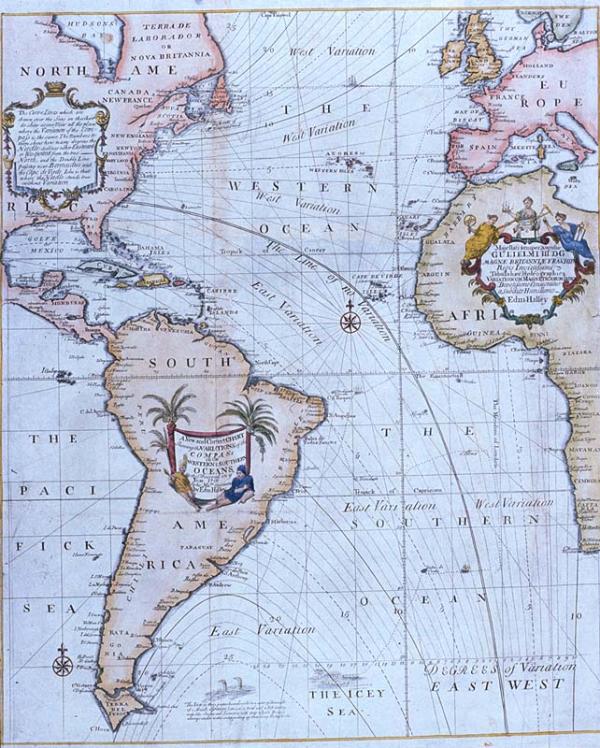
New and Correct Chart Shewing (sic) the Variations of the Compass in the Western & Southern Oceans, A

Sub-Title
As Observed in ye Year 1700
Subject
Western and Southern Oceans, Atlantic Ocean, Eastern Coasts of North America; South America. Compass variation, from true north. Westerm coasts of Europe and Africa, sea-faring map.
Date
1700 (historical)
Mapmaker
Halley, Edmund
Publisher
Mount, R[ichard] and T[homas] Page
Place of Publication
London
Accession Number
1982.077.020
Alternate number
Seiferth Collection
Curatorial Notes
See Phillips, vol. III, #3334, p. 57. Nicely colored. Three cartouches illustrate Indians, palm trees, navigational instruments, horns of plenty.
Notes
Plate 22 from Mount & Page's 1702 "Atlas Maritimus Novus, or the New Sea-Atlas." Interesting map locating Atlantic Ocean in the center of the map, with North and South America, Africa, and Europe shown along the left and right sides. Dedicated to William III.
Size
22 1/4 x 18 3/4