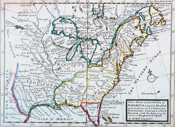
New Map of ye North Parts of America claimed by France under ye Names of Louisiana, Mississipi (sic), Canada & New France, with the Adjoyning (sic) Territories of England & Spain
Subject
North America from Santa Fe to Newfoundland and the Gulf of Mexico to Northern Canada, Indian tribes, forts.
Date
1732 c.
Mapmaker
Moll, H[ermann]
Publisher
[Bowels, Thomas and John]
Place of Publication
[London]
Accession Number
1980.065.002
Curatorial Notes
See Phillips, Vol. 1, p. 325, #578.
Exhibition History
1996 Sep - Mar 1998, So Much More than Just a Map
Notes
Plate 46 from the second edition of Moll's "Atlas Minor." This map was Britain's reply to Deslisle's 1718 "Carte de la Louisiane." Because England had already established trading posts among the Indians in these regions, Mol extended the British borders of Carolina westward into territiory along the Mississippi River already claimed by France.
Size
8 x 10 3/4