Norman's Chart of the Lower Mississippi River
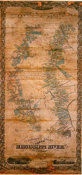
Names of plantation owners and outline of plantations drawn to scale situated on the Mississippi River from Natchez to New Orleans
Norman, B. M.
New Olreans, La.
Facsimilies located Acc. #10168 and T0103.1971; original, in extremely poor condition, located T0055.1997.0755 (OMC 022).
Adaptation of Persac's "Norman's Chart of the Mississippi River from Natchez to New Orleans." Includes visuals titled, "Baton Rouge," "New Orleans," "Cotton Plantation, "Sugar Plantation," and location of railroads, waterways, post offices, churches. Reflects the cadastral land ownership pattern of the arpent system introduced by the French and other settlers. Following Napoleonic inheritance customs, children and grandchildren often built homes one behind the other perpendicular to a bayou or river.