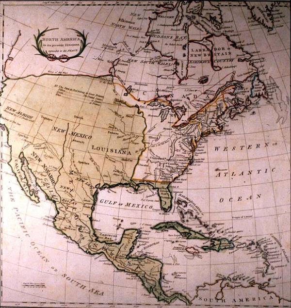
North America in its present Divisions, agreeable to the Peace
Subject
North America, Central America, Caribbean. Location of Indian tribes.
Date
1783 Jun 1
Publisher
Stackhouse, T[homas]
Place of Publication
[London]
Accession Number
T0015.1982
Curatorial Notes
See Phillips, Vol. !, p. 401, #672. From Kahn catalog: this map, published three months before the definitive Treaty of Peace was signed on September 3, 1783, was presumably based on the prelimianry and conditional articles of peace of 1782, and is therefore one of the first maps to indicate the new boundaries of North America following the American Revolution.
Exhibition History
Dec 1982-1984: map exhibition in Presbytere.
Notes
Plate 10 from Stackhouse's 1790 "An Universal Atlas."
Size
15 x 14 1/2