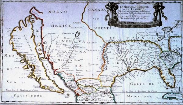
Nouveau Mexique, et la Floride, Le:
Sub-Title
Tirees de diverses Cartes, et Relations
Subject
South and Southwest America, Gulf of Mexico, California as an island, location of Indian tribes.
Date
1656
Mapmaker
Sanson, N[icolas] d' Abbeville
Publisher
Mariette, Pierre
Place of Publication
Paris
Accession Number
1980.174.001
Exhibition History
Dec 1982-1984: map exhibition in Presbytere.
Notes
First map in a printed atlas to concentrate on the south and southwest of North America. The depiction of California as an island caused this to be one of the most lasting and widespread seventeenth and eighteenth century misconceptions in North American cartography. This map is based on the reports of the exporations of fur traders and Jesuit missionaries. On this map the term "Floride Francoise" was used, probably for the first time, to describe the Georgia-South Carolina area as part of the French possessions in the New World.
Size
12 1/4 x 21 1/2