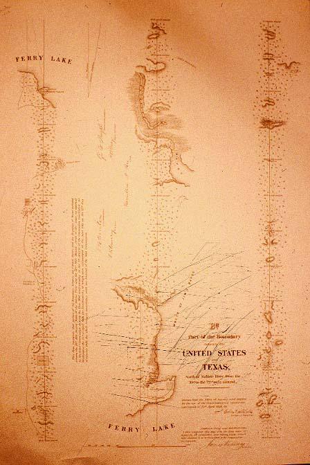
Part of the Boundary between the United States and [the Republic of]Texas, B2.
Sub-Title
North of Sabine River from the 39th to the 72nd. Mile mound.
Subject
Boundary between the United States and the Republic of Texas north of the Sabine River from the 39th to the 72nd. mile mound.
Date
1838 c.
Mapmaker
Blake, J. Edmond; certified by James Kearney
Publisher
U.S. Topographical Engineers
Place of Publication
[Washington, D. C.]
Accession Number
1983.073.005
Curatorial Notes
This is in ribbon map style
Notes
Drawn from the Notes of Survey and copied for the use of the Commissioners under the Convention of 25th April 1838
Size
26 1/2 x 18 3/4