Partie Meridionale de la Riviere de Missisipi (sic)
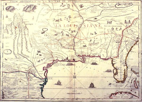
Colonial Louisiana, location of Indian tribes; landmarks.
[Paris]
Outline color. This is a retrogressive map when compared to Deslisle's 1718 foundation map of the same area. While Deslisle made a striking advance in his portrayal of the North American continent, de Fer produced a retogressive map. The western part includes most of the information included in Deslisle's 1703 map of the same area but de Fer returned to Sanson d'Abbeville's 1696 map for the southeast areas. Of the great lakes, only Lake Erie is shown. De Fer's large maps are interesting not only for the information they do not include but also for the scenes of Indian villages, animals, and other drawings scattered about within the map.
Map of North America from Virginia (charleston, South Carolina) of the east cpast to the Zuni Indian tribes of New Mexico and from the Gulf of Mexico north to Lake Erie. Delineates colonial trade and exploration routes, including La Salle's route to Matagora Bay and British tade routes from the east coast to Indian tribes on the Mobile River. Includess images of Indian villages/dwellings, upper left corner.