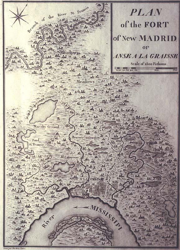
Plan of the Fort of New Madrid or Anse a la Graisse
Fort of New Madrid, [Missouri]; soil erosion
[Bertrand, A.]
[Paris]
Second copy, much worse condition, located T0055.1997.0458. Allegedly, all but 100 copies of the English and 300 copies of the French editions were destroyed. See Phillips, Vol. 1, p. 664, #1214-15.
Plate 30 from George Henry Victor Collot's 1826 "Voyage dans 'Amerique Septentrionale." Mississippi River erosion of fort noted on map: "Fort[,] part of which is already carried off by the waters." Published posthumously, Collot's survey in 1796 was part of an intelligence mission into Spanish Louisiana and Florida in preparation for a possible French attack on the Spanish colonies. Collot was arrested by Governor Carondelet and expelled from the colony. Both English and French editions of the atlas were printed in 1805, but not published until 1826.