Plan of New Orleans & its Environs, A
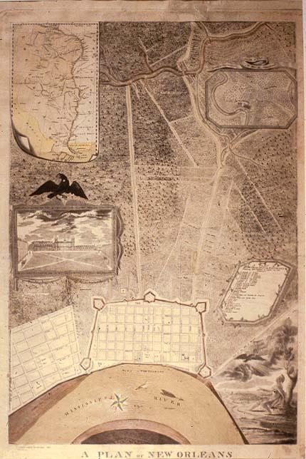
New Orleans; some public buildings located; Faubourg St. Marie (St. Mary); landowners outside French Quarter are identified.
New Orleans, La.
B + W negative stored in Registrar's office. See "Encyclopedia if New Orleans Artists" for additional information re Woiseri. See also 12421.019; T0055.1997.0304-6)
1981: hung in Cabildo, Mayor's Parlor
The first expansion of the city of New Orleans beyond the boundaries of the Vieux Carre was to the west into an area known as Faubourg St. Marie (St. Mary). Published in the year of the Louisiana Purchase, this map features an illustration depicting the enlightenment of Europe by the newly-expanded United States. A seated Roman warrior gazes upward toward an eagle in flight. The bird carries in its beak a United States flag being fifteen stars, the number of states in the union in 1796. Some experts believe the cartouche signifies the United States enlightenment of Indians. According to this interpretation the figure represents a highly classicized rendition of Native Americans.