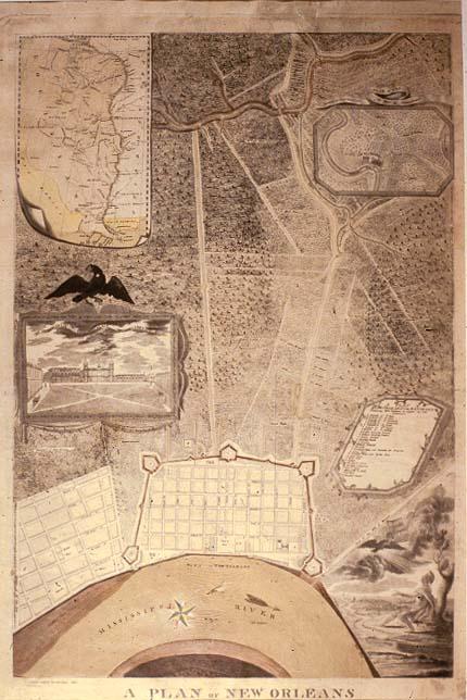
Plan of New Orleans & its Environs, A
Sub-Title
Containing 2600 Fathoms in Length by 1850
Subject
New Orleans; some public buildings located; Faubourg St. Marie (St. Mary); landowners outside French Quarter are identified.
Date
1803 (historical)
Mapmaker
Boqueta de Woiseri, John L.
Place of Publication
New Orleans, La.
Accession Number
T0055.1997.0884
Alternate number
M588
Curatorial Notes
copy work. See original, M0558.
Insets
Plan of the Environs of New Orleans, Six Miles in Circumference; [Lower Mississippi River Valley from Illinois to to the Gulf of Mexico]; engraving, "Esplanade or Place of Arms" [Jackson Square].
Notes
Copywork photograph of the map, dated October 28, 1897. Verso notes, "M. C. Mollock[,] Clarksville, Ga."
Media Type
photograph mounted on board
Size
7 1/2 x 4 1/2