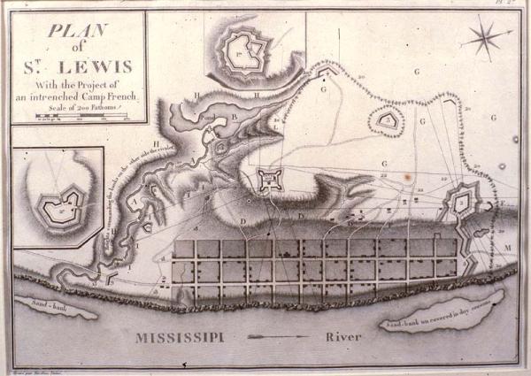
Plan of St. Lewis [Louis]
St. Louis, Missouri, forts
[Bertrand, A.]
[Paris]
Label from 1996 exhibition: St. Louis was laid out in a pattern similar to that of New Orleans. The settlement, designed as a commercial center for the development of the fur trade west of the Mississippi River, was founded by Pierre Liguest Laclede in 1764. Allegedly, all but 100 copies of the English and 300 copies of the French editions were destroyed. See Phillips, Vol. 1, p. 664, #1214-15.
Plate 27 from Georges Henri Victor Collot's 1826 "Voyage dans 'Amerique Septentrionale." Published posthumously, Collot's survey in 1796 was part of an intelligence mission into Spanish Louisiana and Florida in preparation for a possible French attack on the Spanish colonies. Collot was arrested by Governor Carondelet and expelled from the colony. Both English and French editions of the atlas were printed in 1805, but not published until 1826.