Port Hudson and Its Defences
Sub-Title
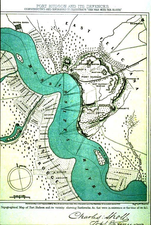
A Topographical Map of Port Hudson and its vicinity, shewing (sic) Earthworks, &c. that were in existence at the time of its fall.
Subject
Port Hudson; Civil War
Date
1863 (historical)
Mapmaker
Sholl, Charles, topographical engineer; W. Kemble, engraver
Publisher
Virtue, Yorston & Co.
Place of Publication
New York
Accession Number
1994.003.014
Curatorial Notes
Second copy located 1981.118. Formerly stored c5d1.
Notes
Constructed and Engraved to Illustrate "The War with the South."
Size
8 1/4 x 6 5/8