Sanitary map of the City of New Orleans
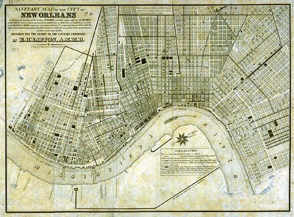
New Orleans, 1853 yellow fever epidemic; Railroads, Canals, Drains or Ditches, pipes for water or gas, Cemeteries, Slaughter houses, Vacheries, Livery stables, Markets, Sugar depots on the levee, Manufactories of soap, tallow, bone, Open basins & unfilled lots, Canals, Drains, Gas works, Fever nests, Crowded boarding houses
Sanitary Commission [of New Orleans]
New Orleans, La.
From, "Report of the Sanitary Commission of New Orleans on the Epidemic of Yellow Fever in 1853," published 1854. Includes delineation of "lines indicat[ing] disturbances of the soil, as digging for Railroads, earth thrown from Canals, Drains or Ditches, or buildings or laying down pipes for water or gas...lines indicat[ing] such Nuisances as Cemeteries, Slaughter houses, Vacharies, Livery stables, Markets, Sugar depots on the levee, Manufactories of soap, tallow, bone, Open basins & unfilled lots, Canals, Drains, Gas works, Fever nests, Crowded boarding houses