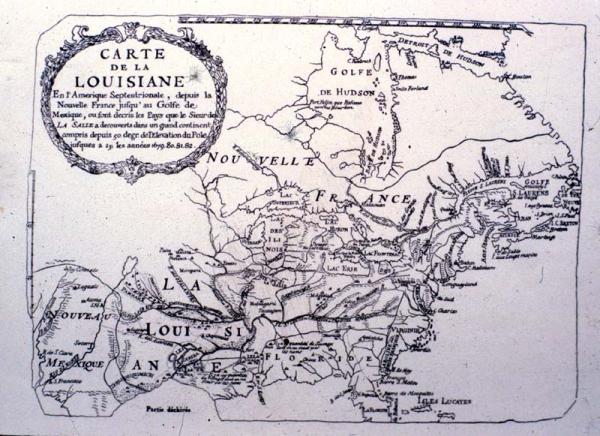
Carte de la Louisiane
Colonial Louisiana from Canada to the Gulf of Mexico
This appears to be a photograph of the original manuscript copy held by the Archives National. See 1955.002.031.001 for "enhanced facsimile reproduction" of this map.
The original manuscript of Franquelin's map, a foundation map of colonial Louisiana formerly stored in the Archives National in Paris, has never been found. This was a foundation or "mother" map of colonial Louisiana. Throughout history, certain maps which, because of accurate details and incorporation of the results of recent explorations, cartographers call "foundation" or "mother" maps. The influence of foundation maps persisted long after later discoveries and settlements because until the nineteenth century, most mapmakers reproduced their predecessors work.