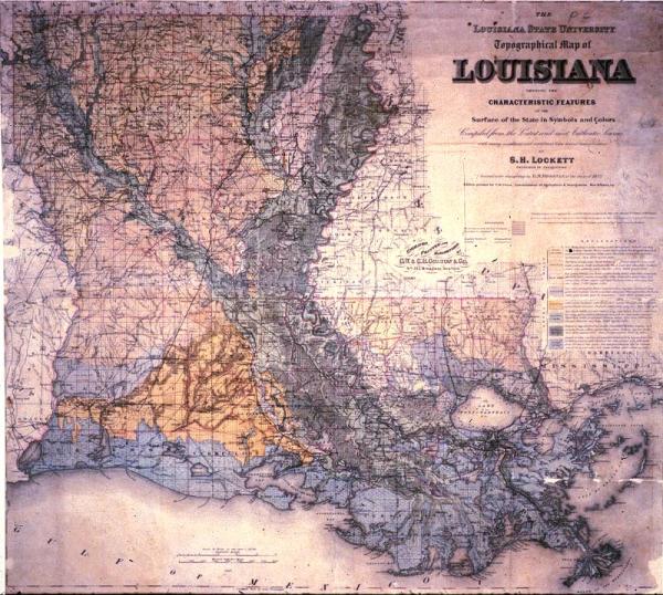
Louisiana State University Topographical Map of Louisiana Showing the Characteristic Features of the Surface of the State in Symbols and Colors
Sub-Title
Compiled from the Latest and most Authentic Sources with many additions and corrections from the actual reconnaissance by S. H. Lockett
Subject
Louisiana; township and range map; railroads
Date
1891
Mapmaker
Lockett, S.H., assisted in the draughting by D. M. Brosnan of the class of 1872
Publisher
Colton, G[eorge] W[oolworth] and C[Charles] B.
Place of Publication
Washington, D. C.
Accession Number
8173.015
Condition
Fair - poor; some fading, foxing; torn along edges and some loss along edges and folds. Needs conservation.
Curatorial Notes
Second copy, poor condition, located T0055.1997.0040
Exhibition History
1982: Lafayette Natural History Museum
Market Value
1982: curatorial insurance estimate $600.00
Notes
Color coded to delineate "good uplands," "pine hills," "bluff lands," "pine flats," "prairies," "alluvial lands," "coast marsh," "wooded swamps."
Media Type
mounted on cloth
Size
30 x 33 1/2
Storage
c03d03