Carte de la Nouvelle France, où se voit le cours des Grandes Rivieres de S. Laurens & de Mississipi Aujour d'hui S. Louis, (sic)
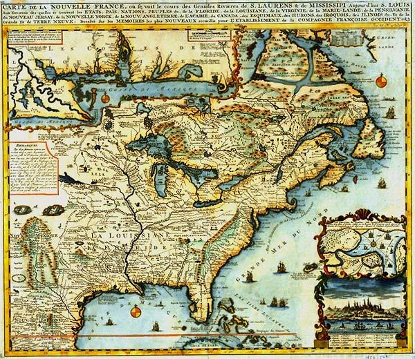
Colonial Louisiana, North America, New France, St. Lawrence and Mississippi Rivers, Mississippi River Delta, Louisiana coastline from the bay of Ascension east to Bay St. Rose (Santa Rosa Island); location of Native American tribes: Eskimo, Inuit, Huron, Iroquois, Illinois; Virginia, Maryland, Pennsylvania, New Jesey, New York, New England, Acadia, , Quebec, Canada; Mobile, Pascagoula.
[L'Honoré & Châtelain]
[Amsterdam]
Nicely colored; the single most beautiful map of colonial Louisiana at the turn of the seventeenth century, before establishment of New Orleans, housed in LSM's collection. Other copies located T0055.1997.0559, T0121.1968. See "Map Collector," #19. Partisan map drafted from the French perspective, few British claims delineated. See Phillips, Vol. 1, p.305-6, #548.
2. Les Environs de Quebec, Ville Capitale de la Nouvelle France avec Titre d'Eveche, Située sur la Riviere de St. Laurens a 308. degrez 17 Minutes de Longitude, et a 46. degrez 55. Minutes de Latitude Septentrionale.
Plate 23 from Châtelain's "Atlas Historique." New Orleans not delineated. This is a version of de Fer's four-sheet map of the area published 1718. Published in order to promote the French Company of the West.