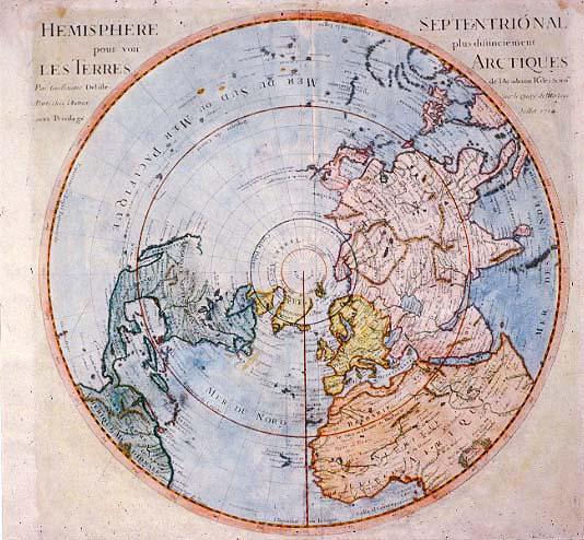
Hemisphere Septentrional pour voir plus distinctement Les Terres Arctiques [Northern Hemisphere Showing Arctic Lands More Clearly]
Arctic, northern hemisphere, northwest passage
Deslisle, Guillaume
[Paris]
Second edition, much worse condition, located T0002.1982. See Phillips, Vol. 1, p.273, #535 for this edition; see Phillips, Vol. 1, p. 327, #580, for second edition.
Throughout the centuries of New World exploration, several different forms of polar projections were used. Some configurations were more distinguished for their artistic elegance rather than their geographical usefulness. Some cartographers, like Deslisle, were more scientific and straightforward in depicting the area. This map reflects a hoped-for discovery of a northwest passage in North America. However, because Deslisle had no information about the area he did not speculate; rather, he left the territory unfinished in the hope that a passage would be discovered.