Louisiana
Louisiana parishes, Nashville Railroad, railroad between Opelousas, la., and Fort Adams, Miss.; railroad between Alexandria, La., and Cheneyville, La. Transportation. Main cities and towns located.
Bradford, T[homas] G[amaliel]
[Boston]
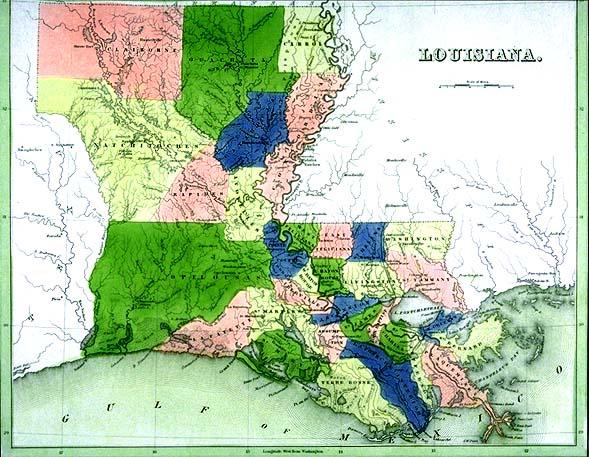
The names of Louisiana parishes tell much of the history of the Pelican State. Several parishes are named for the Native American tribes living in the area at the time of European encounter: Natchitoches, Ouachita, and Avoyelles. Other parishes retained names assigned to the area by Indian inhabitants: Catahoula from the Tensas word, "Cataoola," meaning big, clear lake (Catahoula Lake, now located in La Salle Parish); and Plaquemines from a Mobile Indian and French dialect word for persimmons. Other parish names on this map are French in origin: West and East Baton Rouge (red stick), Lafourche (fork--in the Mississippi River), and Terre Bonne (good earth), and Pointe Coupee (cut point). The Feliciana (happy land) parishes derive their name from the Spanish language as does Concordia (harmony, unity.)
At the time this map was published, Louisiana was divided into thirty-two parishes. During the remainder of the nineteenth and into the first decades of the twentieth century additional parishes were sculpted from the large parishes west of the Mississippi River.