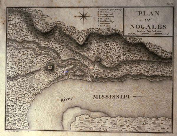
Plan of Nogales
Subject
Nogales [Natchez, Mississippi]; Walnut Hills
Date
1796 (historical)
Mapmaker
Tardieu, [Jean Baptiste Pierre] (l'ainé), engraver
Publisher
[Bertrand, A.]
Place of Publication
[Paris]
Accession Number
2090
Alternate number
Cusachs Collection
Curatorial Notes
Allegedly, all but 100 copies of the English and 300 copies of the French editions were destroyed. See Phillips, Vol. 1, p. 664, #1214-15.
Exhibition History
Dec 1982-1984: map exhibition in Presbytere.
Notes
Nogales was also known as Walnut Hills, and was located near Natchez, Mississippi. Plate 32 from Georges Henri Victor Collot's "Voyage dans 'Amerique Septentrionale." Published posthumously, Collot's survey in 1796 was part of an intelligence mission into Spanish Louisiana and Florida in preparation for a possible French attack on the Spanish colonies. Collot was arrested by Governor Carondelet and expelled from the colony. Both English and French editions of the atlas were printed in 1805, but not published until 1826.
Size
7 3/4 x 10